
Lands Design
Follow Lands Design:
Visit Lands Design:
ADVANCED SOLUTION FOR LANDSCAPE DESIGN
BIM TECHNOLOGY FOR 2D TECHNICAL DRAWINGS, 3D MODELING AND PHOTOREALISTIC RENDERING.
Why use Lands Design?
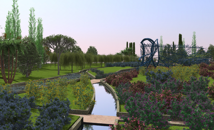
Powerful Terrain Modeling Tools
Create terrains from contours, elevation curves and point clouds. Terrains can be also scanned and imported from the cloud by picking a location from a satellite map. Lands includes tools to modify terrains, add cuts and fills, paths, holes or calculate the volume of land movements. All this data is stored in the terrain and can be modified at any time.
BIM/LIM (Landscape Information Modeling) in your Project
Lands provides smart objects, such as vegetation elements, civil work objects and terrains that can be easily edited and documented in quantity take-offs. Lands provides tools to produce 2D technical drawings that are always linked to the 3D model and to the related lists and documentations.
Extensive Plant Database in 3D / 2D
Lands provides a plant database with more than 1800 species. You can select the ideal plant for your site by filtering the list according to specific criteria: climate, type of soil, wind resistance, flowering and fructification, etc.
Each plant species has its own customizable display modes in 2D and 3D and they are ready for rendering, exporting plans, and season and growth simulation.
Generate Dynamic 2D Documentation
Turn your 2D sketch into a 3D project ready for visualization. Generate 2D technical plans from the 3D model and add dimensions, labels, tags, plant photos and other annotations to get the project ready for documentation. Produce different layouts such as setting out plan, irrigation, and dimension plan by using the layer manager to organize your project. Use the listing tools to generate quantity take-offs for plants, urban furniture elements, zones or volume of cuts and fills from terrain operations.
Parametric Design
Automate design workflows with vegetation, terrains and civil work elements. Save time by avoiding repetitive tasks, create custom functionalities and test different design options faster.
All this is achieved with Grasshopper, a visual programming environment available in the Lands Design version for Rhino.
Bring your Project to Life with Animated Videos and Realistic Images
Present your project with realistic images, virtual tours and animated videos. Walk through the project, play vegetation season change simulation, enable sunlight motion, wind effect and plant growth. In addition, you may apply your desired render engine like Enscape, Lumion, V-Ray, etc.
Latest news on Lands Design
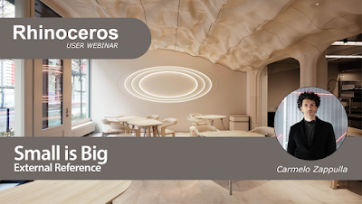
Rhino User Webinar: Small is Big
Rhino User WebinarSmall is Big24 April 2024 at 4:00 pm (CEST)During the Vienna Architecture Conference in 1992, a round table discussion took place at the MAK Austrian Museum of Applied Arts. The participants included renowned architects such as Wolf Prix, Zaha

Summer training for teachers in 3D modeling
Rhino Teacher Training summer workshops This summer, take a class to learn how to add 3D modeling to your design and communication curriculum. We have two 3D modeling workshops for design, drafting, graphics, and technology educators. Using Rhino, you will be guided
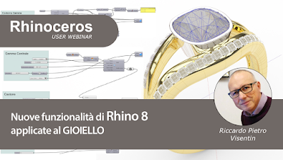
Rhino User Webinar: New Rhino 8 features applied to jewelry – by Riccardo Pietro Visentin (in italian)
Rhino User WebinarNew Rhino 8 features applied to jewelry8 May 2024, 16:00 (CEST)This webinar focuses on new features in Rhino 8 that are changing the way jewelry is designed. These features cover both design in the narrow sense and the visualization and
Enscape 4.0 Adds 95% Parity for Mac in First Cross-Platform Release
Enscape 4.0 is aligning its real-time functionality across operating systems. Architects can now design intuitively on any OS, using new people and vegetation assets, refined user interface elements, and a powerful denoiser to push their designs to the next level."With

Design and Parametric Fabrication Workshop – controlmad
Design and Parametric Fabrication WorkshopJuly 1 - 26 (100 hours) - controlmadEmbark on a comprehensive journey into 3D modeling with Rhinoceros and Parametric Design with Grasshopper. Through this hands-on workshop and practical application, participants delve into...
International Rhino User Meeting Wroclaw (June 7, 2024) – Call for Speakers and Early Bird tickets
Fab Foundation Poland, in collaboration with McNeel Europe, is happy to announce:International Rhino User Meeting WroclawJune 7, 2024A full day of talks by expert Designers (Product, Footwear, Jewelry, Marine, Computation...), Architects, Engineers and Educators, and...

Rhino3Dzine April 2024 issue
Immerse yourself in captivating content in our April issue.Rhino3Dzine has launched a new community. Join us and share your updates!The Talavera Project:Reviving traditional craftsmanship while incorporating advanced digital manufacturing.Unlimited Space:Theatrical...

Curso Introducción a Rhino 8 en inglés y español
Nos complace anunciar nuestro último curso en línea de Rhino3D.Education, diseñado para ayudarle a dar rienda suelta a su potencial creativo con el nuevo Rhino 8.Introducción a Rhino 8 está disponible en inglés y español con subtítulos en inglés, español,

Rhino at BILT Europe – Riga (Latvia) – May 2024
BUILT EUROPE 20247-9 May 2024Riga (Latvia)BILT is an annual event designed to cater to the needs of those who design, build, operate and maintain our built environment. As a community of professionals, it is committed to improving the many ways the