
RhinoLands / Lands Design
Follow RhinoLands / Lands Design:
Visit RhinoLands / Lands Design:
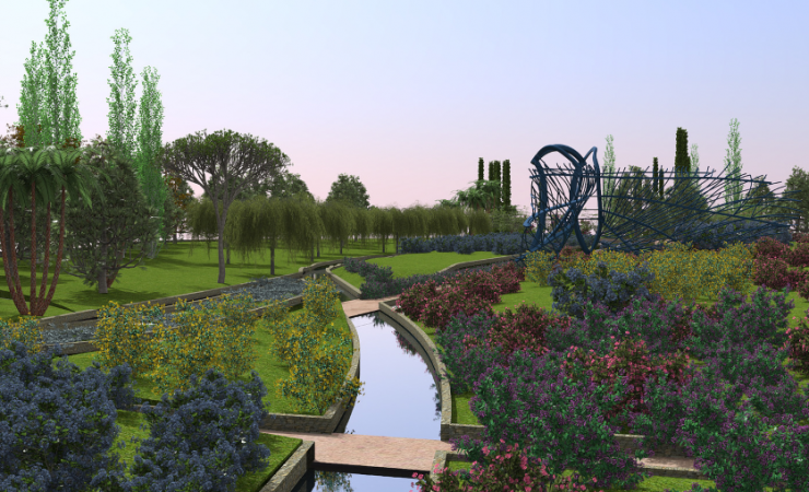
ADVANCED SOLUTION FOR LANDSCAPE DESIGN
BIM TECHNOLOGY FOR 2D TECHNICAL DRAWINGS, 3D MODELING AND PHOTOREALISTIC RENDERING.
Why use RhinoLands / Lands Design?
Powerful Terrain Modeling Tools
Create terrains from contours, elevation curves and point clouds. Terrains can be also scanned and imported from the cloud by picking a location from a satellite map. Lands includes tools to modify terrains, add cuts and fills, paths, holes or calculate the volume of land movements. All this data is stored in the terrain and can be modified at any time.
BIM/LIM (Landscape Information Modeling) in your Project
Lands provides smart objects, such as vegetation elements, civil work objects and terrains that can be easily edited and documented in quantity take-offs. Lands provides tools to produce 2D technical drawings that are always linked to the 3D model and to the related lists and documentations.
Extensive Plant Database in 3D / 2D
Lands provides a plant database with more than 1800 species. You can select the ideal plant for your site by filtering the list according to specific criteria: climate, type of soil, wind resistance, flowering and fructification, etc.
Each plant species has its own customizable display modes in 2D and 3D and they are ready for rendering, exporting plans, and season and growth simulation.
Generate Dynamic 2D Documentation
Turn your 2D sketch into a 3D project ready for visualization. Generate 2D technical plans from the 3D model and add dimensions, labels, tags, plant photos and other annotations to get the project ready for documentation. Produce different layouts such as setting out plan, irrigation, and dimension plan by using the layer manager to organize your project. Use the listing tools to generate quantity take-offs for plants, urban furniture elements, zones or volume of cuts and fills from terrain operations.
Parametric Design
Automate design workflows with vegetation, terrains and civil work elements. Save time by avoiding repetitive tasks, create custom functionalities and test different design options faster.
All this is achieved with Grasshopper, a visual programming environment available in the Lands Design version for Rhino.
Bring your Project to Life with Animated Videos and Realistic Images
Present your project with realistic images, virtual tours and animated videos. Walk through the project, play vegetation season change simulation, enable sunlight motion, wind effect and plant growth. In addition, you may apply your desired render engine like Enscape, Lumion, V-Ray, etc.
Latest news on RhinoLands / Lands Design
Rhinoceros on IRC list for Washington State!
Congratulations to the Rhinoceros community and all users in industries that recommended Rhinoceros be added to the State of Washington IRC software list.Washington Industry Recognized Certification (IRC)State Approved Industry Recognized Credentials List#139 Rhino...
Private Online Rhinoceros 3D & Grasshopper Tutors
Get customized "1-on-1" help from a live Rhino or Grasshopper tutor via Zoom.tutorsandservices.com offers access to a team of tutors and freelancers that are available for hire on an as-needed basis for professional help with your projects or to learn a
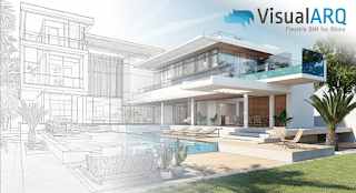
Flexible BIM in Rhino: From Concept Models to Project Drawings with VisualARQ 3
Discover how VisualARQ brings Flexible BIM capabilities to Rhino, enabling architects to develop complete architectural projects. From the early design stages to the production of project drawings and documentation, all within Rhino’s intuitive modeling...
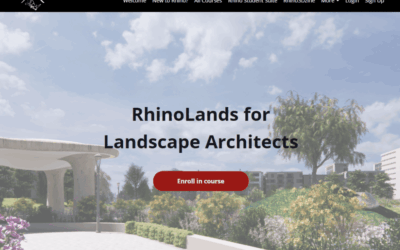
Nuevo curso de RhinoLands en Rhino3D.Education
Nos complace anunciar el lanzamiento de un curso completo de RhinoLands, ahora disponible en la plataforma Rhino3D.Education. Este curso autodidáctico paso a paso es ideal para principiantes, incluso para aquellos sin experiencia previa en CAD o AutoCAD, y avanza...
New RhinoLands Course Released on Rhino3D.Education!
We’re excited to announce the release of a comprehensive RhinoLands course now available on the Rhino3D.Education platform! This self-paced, step-by-step course is ideal for complete beginners—even those with no prior CAD or AutoCAD experience—and gradually advances...
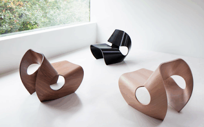
Job offer at Brodie Neill (London, UK) – Technical & Computational Designer
Brodie Neill are on the hunt for a talented Technical & Computational Designer to join its London team tand lead the computational design work for the London based furniture design studio.Working at the intersection of craft, innovation, and sustainability, the
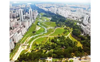
Sponge Cities: Designing Water-Resilient Public Spaces for a Climate-Adaptive Future
As climate change brings more intense storms and unpredictable rainfall, cities must rethink how they handle water. Traditional concrete infrastructure falls short in the face of flash floods and water pollution. Enter the sponge city model—an innovative approach...

Getting to know… OrthoSolid: 3D Printed Orthoses and Prostheses!
Orthobroker has launched OrthoSolid®, a ShapeDiver-powered platform revolutionizing how clinicians design and order custom orthoses and prostheses, digitally, efficiently, and at scale. By replacing traditional methods with a fast, browser-based workflow driven by...

¿Te gradúas este verano? ¡Compra una licencia de Rhino con un 80% de descuento!
¿Te gradúas este verano?¡Compra una licencia de Rhino con un 80% de descuento!Si te gradúas este trimestre, no pierdas la oportunidad de comprar una licencia permanente de Rhino con un 80% de descuento.A diferencia de otras licencias académicas de software,